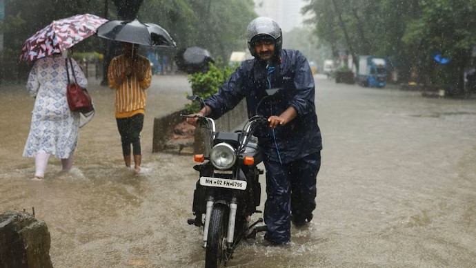
Monsoon Fury: Extremely Heavy Rain Forecasted for Various States on Sunday

The CSR Journal Magazine

The upcoming southwestern monsoon is anticipated to unleash one of its heaviest bursts this season on Sunday, July 5, according to the India Meteorological Department (IMD). The regions expected to experience extremely heavy rainfall include Saurashtra and Kutch, Odisha, Konkan and Goa, the Gujarat region, and Madhya Maharashtra.

This intense weather pattern is primarily influenced by a well-marked low-pressure area located over the northwest Bay of Bengal. This system is likely to move inland towards northern Odisha and northern Chhattisgarh over the ensuing three days, escalating the probability of significant rainfall.

In an early display of the impending monsoon strength, Mangrol in Gujarat’s Junagadh district recorded rainfall of 57 cm within a 24-hour period, classified by the IMD as exceptionally heavy.

Reasons Behind Heavy Rainfall

A low-pressure area signifies a region where atmospheric pressure is lower than the surrounding areas. In such cases, moist air from the sea moves toward this area, rising and cooling to form rain clouds. When these systems become well-defined, they are referred to as well-marked.

The current low-pressure system is supported by an active monsoon trough, an extensive belt of low pressure stretching across the country, positioned further south than usual. This configuration is conducive to increased rainfall in central India.

Additionally, an offshore trough extends from south Gujarat to Karnataka, which also aids in drawing moisture from the Arabian Sea. The convergence of these two moisture sources is significantly enhancing the rainfall potential in the affected regions.

Forecast for Rainfall on July 5

The IMD has issued warnings of extremely heavy rainfall, categorised as exceeding 204.4 mm within a 24-hour period, for isolated areas in Saurashtra and Kutch, Odisha, Konkan and Goa, the Gujarat region, and Madhya Maharashtra. Very heavy rainfall is also expected in parts of West Madhya Pradesh, East Madhya Pradesh, Chhattisgarh, Vidarbha, East Rajasthan, Uttarakhand, Gangetic West Bengal, Telangana, and coastal Karnataka.

Consequently, the department has highlighted concerns over urban flooding, waterlogging, traffic disruptions, and the possibility of localised landslides in hilly regions. Fishermen have been advised to refrain from venturing into large portions of the Arabian Sea and the Bay of Bengal due to the adverse conditions.

Regarding the national capital, Delhi is expected to witness mild rainfall on July 5. The forecast includes a generally overcast sky with light to very light rain, accompanied by thunderstorms, lightning, and gusty winds ranging from 30 km/h to 40 km/h, potentially peaking at 50 km/h.

Current Status of the Monsoon

The northern limit of the monsoon now extends through Jamnagar, Udaipur, Ajmer, Jhunjhunu, Hisar, and Bhatinda. Meteorological conditions are favourable for the further advance of the monsoon into additional areas of Gujarat, Rajasthan, and the remaining parts of Haryana and Punjab within the next four days.

As the monsoon progresses, officials continue to monitor its developments closely. Continued updates will be essential for preparing affected states for the anticipated conditions.

With multiple systems working in tandem, the meteorological outlook remains highly dynamic, and the IMD encourages residents to stay informed and prepared for potential weather-related disruptions.

Long or Short, get news the way you like. No ads. No redirections. Download Newspin and Stay Alert, The CSR Journal Mobile app, for fast, crisp, clean updates!

App Store –  https://apps.apple.com/in/app/newspin/id6746449540 

Google Play Store – https://play.google.com/store/apps/details?id=com.inventifweb.newspin&pcampaignid=web_share

Latest News

Popular Videos