
Monsoon Vanishes as India Faces 64 Per Cent Rain Deficit

Related Articles
A Powerful Monsoon System Brings Record Rainfall to Ahmedabad
Ahmedabad has recorded one of the most significant rainfall events in July this century, driven by a potent monsoon system. The city faced severe...
Identifying Dengue Symptoms Amidst Monsoon Fever Concerns
During the monsoon season, the prevalence of mosquito-borne and water-borne diseases escalates, making it essential to distinguish between dengue and other similar illnesses. This...
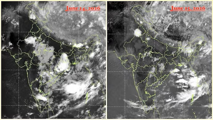
Monsoon Revival Anticipated as Satellite Imagery Indicates Significant Weather Changes
The latest satellite imagery indicates a promising resurgence of the southwest monsoon, which has been relatively inactive for nearly a week. Observations from INSAT-3DR...