


Massive Wall of Warm Water Indicating El Nino Development Observed in Pacific Ocean
The CSR Journal Magazine

A substantial wall of warm water has been detected traversing the Pacific Ocean, as real-time observations from a satellite suggest a robust precursor to an El Nino weather event. Scientists have noted that this phenomenon may potentially influence rainfall and temperature patterns worldwide, affecting regions including India later in the year. With increasing predictions of an intense El Nino in 2026, experts are closely monitoring conditions that could substantiate these forecasts.

Recently, Australia’s Bureau of Meteorology (BOM), a key agency known for tracking Pacific Ocean weather dynamics, announced a likelihood of El Nino’s arrival by June. This warning aligns with findings from a NASA-European satellite, the Sentinel-6 Michael Freilich, which measures water levels across the ocean with high precision.

Launched in 2020 and overseen by the European Space Agency (ESA) as part of the EU’s Copernicus Programme, Sentinel-6 conducts regular measurements that allow scientists to gauge ocean temperatures. A noted correlation exists between warmer waters and increased sea levels, as warmer temperatures result in water expanding, thereby elevating surface levels.

Mechanisms Behind El Nino Development

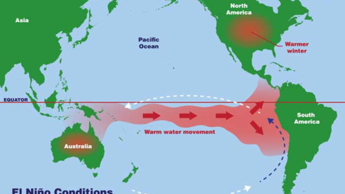
The satellite has recently documented a Kelvin wave, a significant phenomenon characterised by an extensive underwater swell of warm water that travels eastward along the equator. These waves emerge when wind patterns in the far western Pacific alter temporarily, leading to warm water and rising sea levels in the western tropics. Over several weeks, this wave moves eastward and can warm coastal waters, particularly off South America.

As multiple Kelvin waves arrive over time, conditions conducive to El Nino are established, particularly along the coasts of Colombia, Ecuador, and Peru. This accumulation can manifest as erratic weather patterns globally, leading to unusual dryness and inundation. Observations of ocean levels reveal that a Kelvin wave began forming in late January before dissipating, with a new wave emerging in early March, resulting in an increased sea level of over 15 centimetres off the coast of Peru by mid-May.

Experts indicate that compared to previous significant El Nino events, 2023 appears to be starting later. Nevertheless, researchers have acknowledged that its development trajectory is gathering momentum, and the potential extent is still being evaluated.

Global Implications of El Nino Events

El Nino is characterised by more than just changes in the Pacific Ocean; it has far-reaching implications. Alterations in sea surface temperatures can shift the jet stream, significantly affecting global rain patterns and storm behaviours. In moderate cases, the consequences of El Nino are mostly confined to the tropical Pacific region, but more severe occurrences have historically demonstrated broader impacts.

Specifically, strong instances of El Nino are often correlated with the weakening of the Indian monsoon, which poses a threat to agriculture and water resources throughout the subcontinent. This scenario can exacerbate existing issues such as extreme temperatures and water shortages already faced by India.

El Nino events typically reach their peak between November and January, suggesting that the full spectrum of impacts will only become apparent in the forthcoming months. Experts note the variability in El Nino events, but the general trend indicates increased heat and significant changes in rainfall patterns across various global regions.

Long or Short, get news the way you like. No ads. No redirections. Download Newspin and Stay Alert, The CSR Journal Mobile app, for fast, crisp, clean updates!

App Store –  https://apps.apple.com/in/app/newspin/id6746449540 

Google Play Store – https://play.google.com/store/apps/details?id=com.inventifweb.newspin&pcampaignid=web_share

Latest News

Popular Videos
