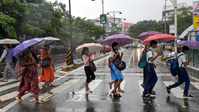
IMD Issues Orange Alert for Delhi as Storm Approaches

The CSR Journal Magazine

The India Meteorological Department (IMD) has issued an orange alert for Delhi, signalling the imminent arrival of thunderstorms, lightning, and strong winds in the region. This alert suggests that residents may experience rain within the next hour, providing some respite after several days of intense heat. Temperatures have reportedly soared above 43°C, leading to discomfort among the population.

The impending weather change is attributed to a weather system moving out of Uttar Pradesh. This system is expected to bring light to moderate rainfall, along with gusty winds, to areas including Noida, Ghaziabad, and parts of north and east Delhi. Satellites show the system causing changes in local weather conditions across the region.

While these initial rain showers may be short-lived, they signify a shift in weather patterns that could provide much-needed relief. Forecasters indicate that although these showers might be brief, they are likely to precede more extensive rainfall later in the day.

Outlook for Delhi-NCR Rainfall

The cluster of clouds approaching Delhi-NCR is expected to result in sudden downpours and thunder in various scattered pockets. This weather activity is largely driven by heat-induced thunderstorms, which are characterised by dust-raising winds followed by rainfall. As the day progresses, the sky is likely to remain partly cloudy, with increased chances of thunderstorms developing.

Although the current rain and wind will be transitory, meteorological predictions indicate the possibility of further thunderstorms in the late evening. This subsequent wave may affect Punjab, Haryana, Delhi-NCR, parts of Rajasthan, and western Uttar Pradesh, extending into the early hours of Friday, June 12. Some regions may experience moderate rainfall with accompanying lightning and gusty winds.

The warning from the IMD highlights the potential for squalls, with winds reaching speeds of 40-60 km/h at times. As such, residents can expect a notable change from the oppressive heat that has prevailed in the capital for several days.

Reasons Behind the Weather Transition

The recent changes in weather are closely linked to a new western disturbance impacting northwest India. Following a significant heatwave, this system is bringing moisture and instability which may lower temperatures in the coming days. The IMD has noted that western disturbances frequently initiate thunderstorm activity, leading to a gradual cooling effect across the region.

In recent days, Delhi-NCR has experienced typical pre-monsoon weather, including dust storms and isolated showers. The shift from hot conditions to more dynamic weather underscores the seasonal transition as intense heating fosters convective activity in the atmosphere.

Overall, Delhi-NCR is projected to experience an active weather day. Intermittent rain and cooling effects are expected as the new weather system introduces a break from the prolonged heat that has affected the region. Residents are advised to remain vigilant as the forecast unfolds, marking the onset of pre-monsoon conditions in the capital.

Long or Short, get news the way you like. No ads. No redirections. Download Newspin and Stay Alert, The CSR Journal Mobile app, for fast, crisp, clean updates!

App Store –  https://apps.apple.com/in/app/newspin/id6746449540 

Google Play Store – https://play.google.com/store/apps/details?id=com.inventifweb.newspin&pcampaignid=web_share

Latest News

Popular Videos