


Why Is Chennai Cloudy but Not Rainy in July?
The CSR Journal Magazine

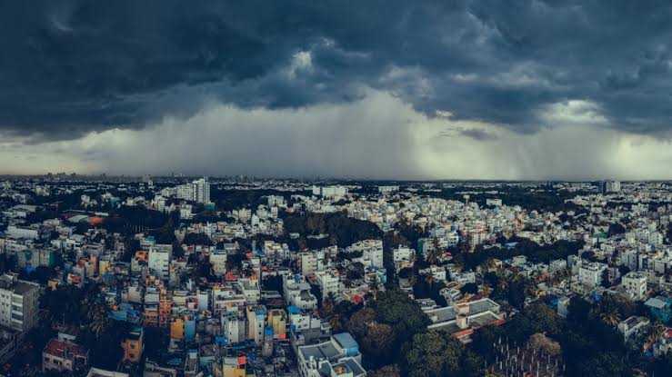
Chennai’s sky may be filled with clouds this July, yet the region has not received significant rainfall. In contrast, parts of Tamil Nadu and the west coast are experiencing heavy downpours. Chennai’s clouds lead to cool temperatures but fail to deliver rain due to specific geographical conditions.

The presence of grey clouds in Chennai’s atmosphere acts as a barrier against the sun’s heat, reducing the ground temperature to around 35 to 36 degrees Celsius. This phenomenon, known as albedo, prevents the city from reaching its potential high of 39 to 40 degrees on a clear day.

The lack of precipitation can primarily be attributed to the Western Ghats, which obstruct the moisture-laden southwest monsoon winds. As these winds travel from the Arabian Sea, they rise and lose their moisture over Kerala. By the time they reach Chennai, they have already dried out, resulting in the city receiving little to no rainfall during this season.

Why Does Chennai Experience Rainfall at Night?

Chennai’s climate features a unique phenomenon where rain mainly falls during the night. This is due to the arrival of residual moisture from the west coast after storms have passed. The westerly winds carry this moisture across the peninsula, often leading to light rainfall in the city hours later.

Following sunset, the thermal conditions change significantly. The cooling of the air leads to a breakdown of the turbulent daytime conditions that typically disrupt cloud formation. As a result, the atmosphere stabilises, allowing for light to moderate rain to develop while the city rests.

These rainfall patterns are influenced by the geographical layout of Tamil Nadu, which experiences effects from both land and marine influences, leading to the variability in rain distribution. Thus, while the day may start dry, the evening can bring much-needed moisture to the area.

Why Does South Tamil Nadu Experience Evening Thunderstorms?

In regions such as Ramanathapuram, Sivagangai, and Pudukottai, localised thunderstorms frequently occur in the evening due to a combination of atmospheric conditions. High temperatures during the day create significant thermal energy, known as convective available potential energy (CAPE), which sets the stage for storm formation.

Simultaneously, cooler, moist air from the Gulf of Mannar and the Palk Strait flows inland, colliding with the warmer, drier air. This interaction leads to the rapid uplift of the moist air, creating ideal conditions for thunderstorm development.

The thunderstorms that result are typically convective in nature, emerging suddenly and persisting only for short periods. This pattern is characteristic of the region, where such storms tend to develop in the early evening, providing brief bursts of intense rainfall while the daytime heating dissipates.

Why Do Rains Return to the West Coast?

The monsoon season is characterised by fluctuating rain patterns driven by the Somali Jet, which carries moisture across the Arabian Sea. When this jet strengthens, the Western Ghats force the moist air upward, leading to widespread rain across areas from Kerala to Konkan.

This surge in rainfall on the west coast has implications for Chennai, where increased precipitation in the west often results in residual moisture drifting towards the east. Consequently, as the rain intensifies along the coastline, Chennai may receive some light showers later at night.

These dynamic weather interactions exemplify the complexities of monsoon systems in India, where geographical barriers significantly influence rainfall distribution, resulting in variances even within close proximities.

Long or Short, get news the way you like. No ads. No redirections. Download Newspin and Stay Alert, The CSR Journal Mobile app, for fast, crisp, clean updates!

App Store –  https://apps.apple.com/in/app/newspin/id6746449540 

Google Play Store – https://play.google.com/store/apps/details?id=com.inventifweb.newspin&pcampaignid=web_share

Latest News

Popular Videos
