


Thunderstorms, Dust Storms, and Rain Forecasted for Delhi-NCR and Rajasthan
The CSR Journal Magazine

Severe thunderstorms accompanied by strong winds, substantial rainfall, and a significant drop in temperatures are anticipated to affect Delhi-NCR and neighbouring areas this evening. Meteorologists have observed increasing weather activity that will likely produce dust storms with gusts reaching 60 to 80 kilometres per hour. This will be followed by moderate to heavy rainfall, thunderstorms, and potential hail in certain locations.

This shift in weather follows an extended heatwave, during which midday temperatures soared to between 44 and 46 degrees Celsius, offering little respite during the nights, as some areas recorded the hottest May minimums in years, exceeding 32 degrees Celsius. Following these extreme conditions, residents can expect some relief.

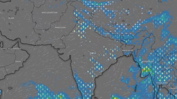
The incoming weather system is reportedly developing near the Rajasthan-Haryana border and is advancing eastward. Satellite images indicate the presence of dense cloud formations extending from Ganganagar towards major urban centres like New Delhi and Agra. Such pre-monsoon thunderstorms are common in late May; however, their occurrence following extreme heat makes this event particularly notable.

Predictions for Affected Areas

Delhi-NCR is forecasted to experience the most significant effects between 7:30 PM and 11 PM, with estimates suggesting that 60 to 80 per cent of the area will be impacted. Strong winds may initially stir up dust, leading to reduced visibility. Residents are advised to secure loose items, close windows, and avoid unnecessary travel during peak storm activity.

The anticipated rainfall is expected to provide quick relief, followed closely by thunder and lightning, adding intensity to the weather event. Areas in Haryana will begin to feel the effects around 4:30 PM until approximately 9:30 PM, covering a considerable portion of the state.

Punjab is scheduled to witness storm activity between 5:30 PM and 10 PM, while Chandigarh may experience the full impact starting at 8 PM and continuing into the night. In Uttar Pradesh, western and southwestern districts are projected to encounter weather changes from 5 PM to 11 PM, with northwestern regions affected later, between 8 PM and 1 AM. Localised updates will be essential, as timings may vary slightly by location.

Impact on Weather Patterns

While the weather change this evening will not signify the complete end of summer, it is expected to alleviate some of the oppressive heat that has enveloped the region. Although the official onset of the monsoon has been postponed, this preview marked by strong winds, lightning, and rain will serve as a temporary reprieve for residents.

Cooler gusts are on the horizon, and after enduring a prolonged period of heat, many individuals will welcome this refreshing change. The impending arrival of this weather system promises not just a brief respite from the heat, but also a chance for farmers and residents alike to prepare for the forthcoming agricultural season.

Residents in affected regions are encouraged to remain informed through local alerts and news updates, as the evening progresses and the weather system approaches. By staying aware of the latest developments, individuals can best prepare for the anticipated storms and ensure their safety during this significant weather event.

Long or Short, get news the way you like. No ads. No redirections. Download Newspin and Stay Alert, The CSR Journal Mobile app, for fast, crisp, clean updates!

App Store –  https://apps.apple.com/in/app/newspin/id6746449540 

Google Play Store – https://play.google.com/store/apps/details?id=com.inventifweb.newspin&pcampaignid=web_share

Latest News

Popular Videos
