


Monsoon Pause in India: July Weather Mirror of April
The CSR Journal Magazine

The current weather in India presents a puzzling scenario for July, traditionally marked by heavy monsoon rainfall. Data from weather satellites indicate that the skies over central and southern India are surprisingly clear, resembling conditions more typical of April rather than the expected downpours of mid-July. The India Meteorological Department (IMD) noted on July 10 that rainfall activity is anticipated to be subdued for at least six to seven days.

This unexpected lull in monsoon activity comes after one of the driest Junes in over a century, followed by a brief period of rainfall during early July. Meteorologists describe this phenomenon as a break in the monsoon, which is not unusual but is notably inconvenient this year.

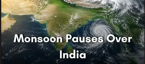
Satellite imagery from the Isro’s INSAT weather satellites reveals a stark absence of the usual cloud formations, with the Arabian Sea and Bay of Bengal showing fewer clouds than normal. Areas that should be receiving abundant rains, such as the Western Ghats, are instead under clear skies. The first week of July showcased robust cloud systems, feeding moisture to key regions, but this week has seen a significant reduction in cloud activity.

Factors Contributing to the Monsoon Break

The primary factor behind the current pause in rainfall is the position of the monsoon trough, a belt of low pressure that usually extends across central India. When positioned correctly, this trough draws in moist air from the Arabian Sea and Bay of Bengal, resulting in widespread rainfall. However, as the trough shifts northward to the Himalayan foothills, it prevents rainfall from reaching many regions in central and peninsular India, where air is instead subsiding, leading to warmer and drier conditions.

Recent forecasts from the IMD indicate an uptick in isolated heavy rainfall over northeastern states, West Bengal, Sikkim, and Bihar due to this northward shift. Meanwhile, central India continues to experience a lack of moisture, which exacerbates the prevailing heat and humidity.

Moreover, the absence of low-pressure systems originating from the Bay of Bengal further restricts rainfall. Such systems typically traverse inland, providing much-needed moisture to central India during the monsoon season. The last notable depression occurred on July 5, leading to brief but intense rains; however, there has been no subsequent system to follow it.

Influence of Global Phenomena on Regional Weather

The current weather situation is also influenced by wider climatic patterns such as El Niño and the Madden-Julian Oscillation (MJO). El Niño, defined by warmer ocean temperatures in the central and eastern Pacific, affects atmospheric pressure and wind patterns globally. The IMD reports weak El Niño conditions currently prevailing, contributing to the deficits experienced in June.

At the same time, the MJO, a recurring pulse of cloud and rain, is currently in a phase that suppresses rainfall over the Indian subcontinent. This global weather pattern impacts local weather conditions by preventing the formation of rain-bearing clouds in the region.

Forecasts from the IMD suggest a potential improvement in rainfall towards the latter half of July, as the monsoon trough is expected to return to a more favourable position. Anticipated low-pressure areas forming over the northwest Bay of Bengal may reignite the monsoon, benefiting the critical agricultural sectors that are now suffering under the current dry spell.

Long or Short, get news the way you like. No ads. No redirections. Download Newspin and Stay Alert, The CSR Journal Mobile app, for fast, crisp, clean updates!

App Store –  https://apps.apple.com/in/app/newspin/id6746449540 

Google Play Store – https://play.google.com/store/apps/details?id=com.inventifweb.newspin&pcampaignid=web_share

Latest News

Popular Videos
