


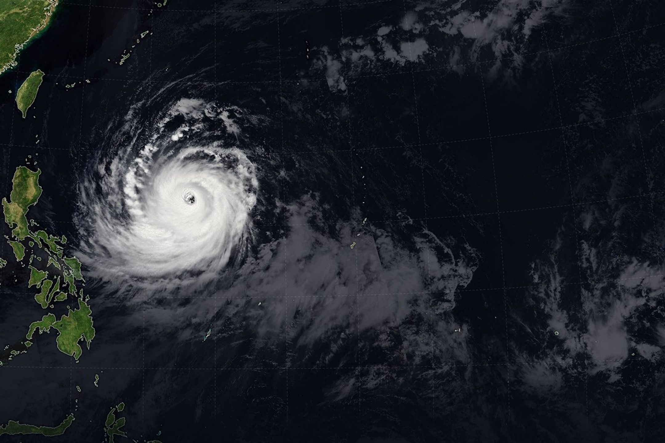
Nasa Captures Stunning View of Super Typhoon Bavi from Space
The CSR Journal Magazine

Nasa has captured a remarkable view of Super Typhoon Bavi as it intensified over the Pacific Ocean. This powerful storm was recorded by the Moderate Resolution Imaging Spectroradiometer (MODIS), which is onboard the Terra satellite. The imagery reveals a well-defined eye and symmetrical cloud structure, indicative of the typhoon’s strength and organisation.

According to Nasa, Bavi was categorised as a super typhoon, a classification reserved for storms with maximum sustained winds exceeding one hundred and fifteen miles per hour. The satellite imagery provides valuable data on the storm’s development and potential impact on surrounding areas.

The observation was made on September 2, 2020, when Bavi reached its peak intensity. The storm’s path was closely monitored to determine its trajectory and likelihood of making landfall in populated regions. This advanced forecasting plays a crucial role in preparedness and response measures by local authorities.

Impact and Forecasting of Typhoon Bavi

In the days leading up to the observation, Super Typhoon Bavi impacted many areas, causing disruption and damage. The government agencies in affected regions were alerted to the impending threat, allowing for the implementation of emergency measures. Evacuations were ordered in several areas expected to bear the brunt of the storm.

Nasa’s satellite imagery not only helps in understanding the storm’s current state but also assists meteorologists in forecasting its path. Data collected from the satellite is utilised in creating detailed weather models that predict the storm’s movement and potential impact on coastal communities across the region.

Additionally, the collaboration between Nasa and various meteorological organisations ensures that updated information is always available. This partnership allows for rapid dissemination of alerts and warnings to communities at risk, thereby enhancing safety measures during severe weather events.

Significance of Satellite Observations in Weather Prediction

The role of satellite observations in weather prediction has become increasingly vital over the years. Nasa’s technology enables scientists to monitor large weather systems in real-time, providing insights into their formation and evolution. This capability is crucial for timely emergency responses, especially with storms like Bavi.

High-resolution satellite data allows for a comprehensive understanding of atmospheric conditions, cloud formation, and wind patterns. Researchers utilise these insights to improve forecasting models, thereby increasing the accuracy of storm predictions and reducing the risks posed to human lives and property.

Moreover, these satellite missions contribute to ongoing scientific research, with findings helping to understand climate change and its effects on storm behaviour. Observing storms like Super Typhoon Bavi aids in advancing the broader field of meteorology, making it possible to anticipate future weather patterns.

In summary, Nasa’s capture of Super Typhoon Bavi from space underscores the importance of satellite technology in modern meteorological practices. By providing essential insights during significant weather events, such observations ultimately serve to enhance public safety and readiness in the face of natural disasters.

Long or Short, get news the way you like. No ads. No redirections. Download Newspin and Stay Alert, The CSR Journal Mobile app, for fast, crisp, clean updates!

App Store –  https://apps.apple.com/in/app/newspin/id6746449540 

Google Play Store – https://play.google.com/store/apps/details?id=com.inventifweb.newspin&pcampaignid=web_share

Latest News

Popular Videos
