


India Raises Concerns Over UN Map Showing Arunachal Pradesh and Aksai Chin
The CSR Journal Magazine

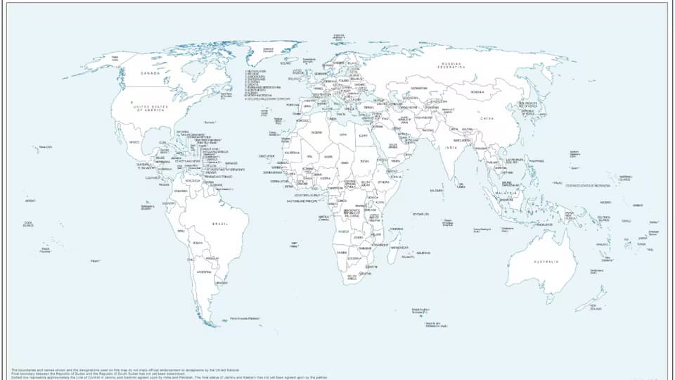
A newly issued United Nations world map has controversially depicted Arunachal Pradesh and Aksai Chin as distinct regions, situated between the demarcation lines claimed by India and China. New Delhi asserts that Arunachal Pradesh is an integral part of India’s sovereign territory, while Aksai Chin is considered a portion of Ladakh. In response to what it describes as anomalies in the map, the Ministry of External Affairs (MEA) has formally addressed the matter with relevant UN officials.

This action follows India’s recent support for a resolution passed by the UN General Assembly aimed at promoting the use of equal-area maps. It is important to note that India underscored its backing for the resolution should not be interpreted as an endorsement of any specific map, including those that depict disputed territories.

The UN Resolution on Equal-Area Maps

The UN General Assembly adopted the “Correct the Map” resolution, which has received backing from the African Union, on September 4. This initiative advocates for a greater emphasis on equal-area projections in mapping, to ensure the accurate portrayal of the relative sizes of countries and continents. India’s support is primarily rooted in the resolution’s focus on these cartographic principles.

During a press briefing, MEA spokesperson Randhir Jaiswal reiterated that India’s endorsement was strictly in alignment with the principles of equal-area mapping. He clarified that the resolution does not validate any specific map or address issues relating to territorial disputes. Jaiswal stated, “We voted in favour of the resolution, while also issuing a statement to clarify that it does not endorse any map of any specific entity.” This highlights India’s cautious approach towards the implications of the resolution.

The UN map in question was initially released on July 1 during discussions surrounding the resolution. Notably, it portrays Arunachal Pradesh without its boundary with Nagaland, seemingly presenting it as a separate entity, with Assam and China positioned on either side. Likewise, Aksai Chin is displayed distinctly, despite India regarding it as part of Ladakh.

Clarification on Representation of Borders

India has sought to emphasise a clear distinction between the general UN resolution and political interpretations of borders, aimed at maintaining its territorial integrity. Jaiswal explained that the resolution “neither adopts nor authenticates any particular world map” and does not clarify political cartography or disputes over international boundaries.

India’s support for the resolution has been framed as an endorsement of the underlying principles promoting equal-area cartography. This clarification is particularly relevant in relation to the recent map’s presentation, underscoring that support for a mapping methodology does not concede grounds on territorial sovereignty.

In a firm declaration, Jaiswal affirmed India’s position by stating that any representation that deviates from India’s territorial claims would not be accepted. “Our position on India’s sovereignty and territorial integrity is clear, consistent, and non-negotiable,” he asserted, highlighting India’s commitment to its official map portrayal.

Context of the Mapping Debate

The emphasis on equal-area maps stems from widespread concerns regarding the distortions intrinsic to traditional mapping practices, such as the Mercator projection. This method, developed in the 16th century primarily for navigation, tends to exaggerate the size of landmasses located further from the equator.

The Equal Earth projection, introduced in 2018, aims to resolve such discrepancies by maintaining the proportionality of land areas without sacrificing recognisable shapes. The “Correct the Map” resolution further promotes improved visual representation and clarity in educational and public messaging contexts.

It is essential to note that while this initiative offers an upgraded perspective on global mapping, it does not legally redefine national borders, resolve territorial disputes, or compel governments to abandon their current mapping practices.

Long or Short, get news the way you like. No ads. No redirections. Download Newspin and Stay Alert, The CSR Journal Mobile app, for fast, crisp, clean updates!

App Store –  https://apps.apple.com/in/app/newspin/id6746449540 

Google Play Store – https://play.google.com/store/apps/details?id=com.inventifweb.newspin&pcampaignid=web_share

Latest News

Popular Videos
