


India Recognises 28 Landmarks in Ladakh Amid Border Disputes
The CSR Journal Magazine

The Union Home Ministry of India has officially recognised 28 landmarks and geographical features in Ladakh, including several located in regions claimed by China. This significant step aims to formalise the names of these locations on India’s official maps. The initiative follows careful consultations with the Union Territory of Ladakh and reflects India’s commitment to asserting its territorial integrity.

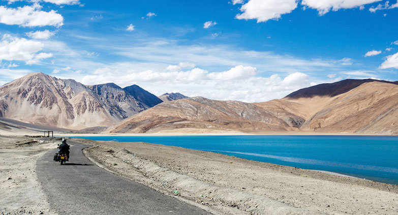
This move by the Union Government encompasses various geographical formations such as peaks, mountains, passes, glaciers, valleys, rivers, and lakes. The newly approved names are intended to provide a clear and standardised identification for these features. This action aligns with ongoing efforts to reinforce India’s presence in contested areas.

Details of the Newly Standardised Names

The list of geographical features includes notable names such as Zorawar Peak, Kanishka Peak, Atisha Giri, Martand Giri, and Rinchen Zangpo. Other peaks recognised include Sakyashree Giri and Marpa Lotsawa Ri. In addition, several mountains have been given formal recognition, which includes Karun Pir, Drak Karpo, and Zolmori, among others.

Mentioned in the official list are strategic passes and glaciers, including Chapchingle Pass and Shachmirk Pass, as well as the Parpik and Skamari glaciers. Furthermore, the Shkorga Valley has also been named, reflecting the diversity of terrains in the region. Locations such as Brangsa, Kuksel, Dehra Compass, Gogra, Kumarayan Point, Panglung, and Shamal Lungpa have now been officially identified.

Notably, Dehra Compass is situated in the disputed Aksai Chin region, an area that is claimed by China. Along with these prominent geographical features, the official names also include Guru Rinpoche Lake, Yangpa River, and a Hot Spring, all of which are now standardised.

Government’s Objective Behind the Initiative

This exercise is reportedly intended to enhance the accurate identification of key locations in Ladakh while promoting public awareness about these areas. By standardising these names, the government aims to strengthen its administrative control and cultural connection over the region. The initiative underscores the importance of local identity in the face of ongoing border disputes.

The inclusion of these names on the official Survey of India map illustrates a broader strategy to assert India’s claims in contested territories. The decision to formalise these geographical features contributes to a clearer representation of sovereignty and demonstrates the government’s intention to maintain its stance amidst regional tensions.

Moving forward, the government will likely continue to focus on the representation of Ladakh in official documents and maps. This may encompass further cartographic initiatives aimed at bolstering national claims in various regions. The recognition of these 28 geographical features serves as a significant step in this ongoing process of territorial affirmation.

Long or Short, get news the way you like. No ads. No redirections. Download Newspin and Stay Alert, The CSR Journal Mobile app, for fast, crisp, clean updates!

App Store –  https://apps.apple.com/in/app/newspin/id6746449540 

Google Play Store – https://play.google.com/store/apps/details?id=com.inventifweb.newspin&pcampaignid=web_share

Latest News

Popular Videos
