


Major Traffic Jam on Mumbai-Bengaluru Highway Amid Maharashtra Karnataka Border Farmers’ Protest
The CSR Journal Magazine

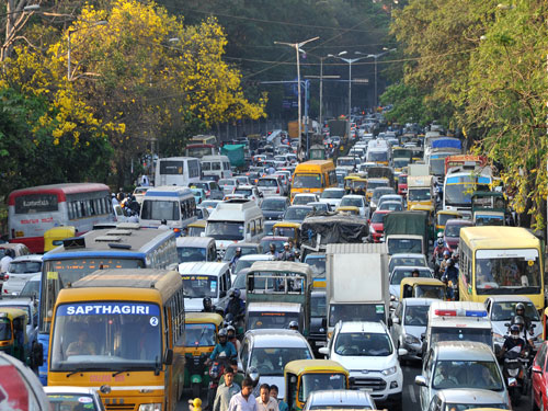
The ongoing farmers’ protest has significantly disrupted vehicular traffic on the Mumbai-Bengaluru National Highway. This situation arose on Wednesday, 4 October 2026, at the Maharashtra-Karnataka border, where demonstrators have been rallying since Tuesday morning. The protest is primarily focused on grievances related to sugarcane prices, ethanol rates, and other agricultural demands.

As a result of the protest, the police have advised commuters to avoid the affected route and seek alternative paths. Inspector General of Police for the Kolhapur Range, Ranjan Kumar Sharma, has issued a statement urging the public to consider different travel options to circumvent the congestion caused by the agitation.

Authorities have also reached out to Google Maps, requesting that the platform mark the affected stretch of National Highway no. 48 as closed. This measure aims to inform drivers of the ongoing situation and prevent further traffic complications.

Police Advise on Alternative Routes

In light of the protest, the police have identified two alternative routes for travellers. The first route leads through Satara, Rahimatpur, Vita, Tasgaon, Miraj, Gokak, and Belagavi. The second alternative includes a path through Satara, Karad, Islampur, Ashta, Miraj, Kagwad, Gokak, and Belagavi. These routes have been designated to facilitate smoother travel for those who must journey through the area.

Dr Shivaji Pawar, Superintendent of Police for the Pune Range, confirmed that the situation remained unchanged as of Wednesday morning. He reiterated the importance of avoiding travel on NH-48 unless absolutely necessary, as the protest is expected to cause ongoing delays and traffic congestion.

Sharma emphasised that the police would keep the public informed about any improvements in the situation. He assured that once normal traffic flow resumes, the advisories regarding the road closure would be lifted.

Google Maps Requested to Update Traffic Information

The police have formally requested Google Maps to display alerts concerning the road closure and to provide real-time information about traffic congestion and delays. This initiative aims to enhance safety for long-distance passenger vehicles and heavy goods vehicles navigating the highway.

Sharma highlighted the importance of these updates for ensuring that drivers are not directed through the affected stretch until the protest concludes. The police are committed to working closely with Google Maps to ensure that the information is accurate and timely.

In preparation for the increased traffic on alternative routes, necessary arrangements have been made with the assistance of traffic police and local law enforcement. Sharma has urged travellers to utilise these alternative paths if their journey is essential, thereby minimising the impact of the protest on the main highway.

As the protest continues, the police remain vigilant and are monitoring the situation closely. They are prepared to provide updates to the public as conditions evolve, ensuring that commuters are well-informed about their travel options.

Long or Short, get news the way you like. No ads. No redirections. Download Newspin and Stay Alert, The CSR Journal Mobile app, for fast, crisp, clean updates!

App Store – https://apps.apple.com/in/app/newspin/id6746449540

Google Play Store – https://play.google.com/store/apps/details?id=com.inventifweb.newspin&pcampaignid=web_share

Latest News

Popular Videos
