


Bay Of Bengal Deep Depression Unlikely To Become Cyclone Before Landfall
The CSR Journal Magazine

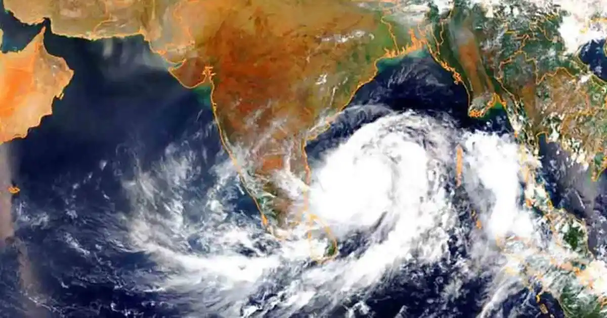
The deep depression over the Bay of Bengal is unlikely to intensify into a cyclonic storm before making landfall, with the India Meteorological Department (IMD) forecasting that the system will cross the north Andhra Pradesh-South Odisha coast as a deep depression on Wednesday night.

At 8:30 am on September 23, the system was located over the westcentral and adjoining northwest Bay of Bengal, around 60 km southeast of Kalingapatnam in Andhra Pradesh. It had been moving westwards at around 5 kmph over the previous six hours.

The IMD expects the system to turn west-northwestwards and cross the north Andhra Pradesh-South Odisha coasts between Visakhapatnam and Gopalpur, close to Kalingapatnam, by Wednesday night.

Deep Depression Under Continuous Monitoring

The forecast means the system is expected to retain its status as a deep depression rather than intensify into a cyclonic storm before reaching the coast.

The system is being continuously monitored by the Doppler Weather Radar at Visakhapatnam, which is tracking its movement and structure as it approaches the coast.

While attention has also focused on the possibility of the system being named “Cyclone Arnab”, the immediate weather threat remains linked to the rainfall, winds and sea conditions associated with the deep depression.

Heavy Rainfall Forecast For Odisha, Andhra Pradesh

Despite the system not being expected to become a cyclone before landfall, the IMD has warned of significant rainfall across Odisha and Andhra Pradesh.

Odisha is likely to receive light to moderate rain at most places, with heavy to very heavy rainfall expected at several locations and extremely heavy rainfall at isolated places over south Odisha on September 23 and 24.

Heavy to very heavy rainfall could continue at isolated locations in the state on September 25 and 26.

Coastal Andhra Pradesh and Yanam are also expected to receive widespread rainfall, with heavy to very heavy rain at several places and extremely heavy rainfall on September 23 and 24. Heavy rain could continue at isolated locations on September 25.

Rough Seas To Persist

The weather system is also expected to keep sea conditions hazardous along the affected coastline. Very rough seas are likely over the westcentral and northwest Bay of Bengal until the evening of September 24, before conditions gradually improve.

Rough to very rough sea conditions are also expected along and off the north Andhra Pradesh, Odisha and West Bengal coasts during this period.

With the system expected to reach the coast as a deep depression, the immediate concern is therefore not whether it becomes a cyclone or what name it may receive, but the heavy rainfall, strong winds and dangerous sea conditions expected as it approaches land.

Long or Short, get news the way you like. No ads. No redirections. Download Newspin and Stay Alert, The CSR Journal Mobile app, for fast, crisp, clean updates!

App Store –  https://apps.apple.com/in/app/newspin/id6746449540 

Google Play Store – https://play.google.com/store/apps/details?id=com.inventifweb.newspin&pcampaignid=web_share

Latest News

Popular Videos
