


UN Votes to Amend World Map for Accurate Representation of Africa
The CSR Journal Magazine

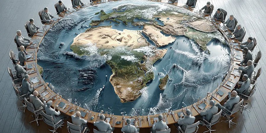
The United Nations has endorsed a resolution aimed at moving away from the traditional Mercator world map in favour of a projection that more accurately reflects the relative sizes of nations. The “Correct the Map” initiative was passed by the UN General Assembly on September 3, 2026, with a vote of 164 in favour, one against, and six abstentions. The United States stood as the sole nation opposing the resolution.

The proposal was spearheaded by Togo and received strong backing from the African Group. Proponents of the initiative have argued that the continued usage of the Mercator projection, originating from the 16th century, distorts the true size of Africa, making it seem significantly smaller and more marginalised than it actually is.

The African Union welcomed the voting result as a significant milestone in achieving fair global cartographic representation. Initially approved by the African Union Assembly in February 2026, the proposal was later introduced at the UN level.

Issues With the Mercator Projection

The Mercator projection, created by Flemish cartographer Gerardus Mercator in 1569, transforms the Earth’s spherical shape into a flat rectangular map, which inherently leads to distortions. While it preserves directional accuracy and shapes of smaller regions, this projection dramatically enlarges land masses as they move away from the equator.

As a result, countries located in northern latitudes, such as Greenland, appear disproportionately large compared to Africa, which is approximately 14 times its size. This misrepresentation extends to Europe, North America, and Russia, making them appear larger in relation to continents closer to the equator.

The debate surrounding the Mercator map lies in its widespread application in educational and public settings. Many individuals may mistakenly assume it accurately depicts the relative sizes of nations and continents, leading to misconceptions about geography.

Introduction of the Equal Earth Projection

The Equal Earth projection is described as an equal-area map that ensures countries and continents are depicted in proportion to their actual surface areas while preserving their recognisable shapes. This projection significantly alters the perceived size of Africa compared to the Mercator map, showing it as much larger and providing a more equitable visual understanding of the world.

Supporters of the Equal Earth projection argue that it diminishes the historical prominence given to Europe and North America, offering a more balanced view of global geography. Togo’s Foreign Minister, Robert Dussey, suggested it delivers the “best perception” of the relative sizes of continents.

While the UN resolution encouraging the adoption of the Equal Earth projection is not legally binding, it aims to inspire educational institutions, public communication, and other platforms where accurate geographic comparisons are essential. The resolution stops short of challenging the use of the Mercator map for navigation purposes, wherein its directional qualities remain advantageous.

Advocacy for Change Among African Nations

African states have pushed for this change, highlighting that the representation in maps can shape perceptions of power and significance globally. They argue that the Mercator projection has led to generations of students receiving a distorted understanding of Africa’s true geographical scale.

The endorsement of the “Correct the Map” initiative by the African Union Assembly and the subsequent push at the UN by Togo illustrate a concerted effort to confront remnants of colonial-era narratives in geographical representations. Dussey stressed that while the initiative is not aimed at undermining European influence, it strives to pave the way for a more accurate portrayal of Africa’s place in the world.

Future Steps Following the Resolution

In the wake of the resolution, Togo aims to replace the Mercator projection in its educational geography materials before the end of the year, setting a potential precedent for other nations. Dussey expressed the ambition to lead by example, with hopes that other countries, international organisations, and technology firms will follow suit in adopting Equal Earth maps.

Efforts will be made to engage with other African Union members and relevant stakeholders over the next six months to devise a strategy for broader adoption of the Equal Earth projection. The immediate implications of the resolution are likely to be limited, as its enforcement is voluntary, dependent on widespread acceptance by educational bodies and map publishers.

Long or Short, get news the way you like. No ads. No redirections. Download Newspin and Stay Alert, The CSR Journal Mobile app, for fast, crisp, clean updates!

App Store –  https://apps.apple.com/in/app/newspin/id6746449540 

Google Play Store – https://play.google.com/store/apps/details?id=com.inventifweb.newspin&pcampaignid=web_share

Latest News

Popular Videos
