


Cyclone Murasu: IMD Predicts Landfall Location and Likely Impact Areas
The CSR Journal Magazine

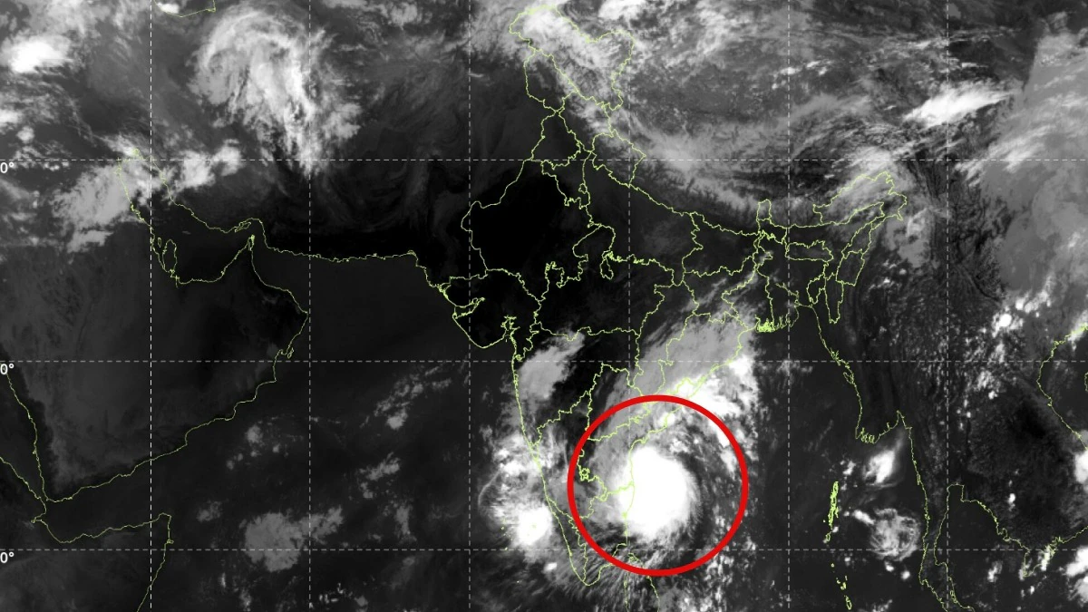
IMD Monitoring Cyclone Murasu’s Progress

Severe Cyclonic Storm Murasu is advancing towards India’s eastern coastline, prompting the India Meteorological Department (IMD) to closely monitor its trajectory. The cyclone is expected to bring significant rainfall across various southern and central states, with alerts issued for heavy precipitation in coastal Andhra Pradesh, Rayalaseema, and Telangana on November 2 and 3. Tamil Nadu is also anticipated to experience substantial rainfall on November 2.

The IMD has specifically warned that certain regions in coastal Andhra Pradesh, including Yanam and Rayalaseema, may face extremely heavy rainfall on November 2 and 3. Telangana is similarly under a warning for extremely heavy rainfall on November 3, raising concerns about potential flooding and waterlogging in vulnerable areas.

Forecasted Landfall Timing and Location

The IMD forecasts that Cyclone Murasu will make landfall along the southern Andhra Pradesh coast late on the night of November 2, extending into the early hours of November 3. The cyclone is projected to move northwestward and cross the coastline between Nellore and Narsapur, situated south of Ongole, as a severe cyclonic storm.

The expected landfall window is between 11:30 pm on November 2 and 4 am on November 3. The storm is predicted to generate sustained wind speeds of 100-110 kmph, with gusts potentially reaching up to 120 kmph. Such wind speeds can pose risks to infrastructure, uproot trees, and disrupt power supply and transportation.

The combination of heavy rainfall and strong winds is likely to lead to waterlogging, flash flooding, and damage to infrastructure. Areas that are low-lying and communities located along the coast are expected to be particularly at risk during this period.

Significance of the Landfall Forecast

The predicted landfall corridor places numerous populated coastal districts of Andhra Pradesh directly in the cyclone’s path. With wind speeds that could reach up to 120 kmph and the potential for extremely heavy rainfall, it is vital for authorities to ensure preparedness and facilitate timely evacuations from at-risk locations.

Authorities must also monitor river levels, drainage systems, and low-lying settlements as the cyclone approaches. The next few hours are critical as Murasu nears the coast, with any changes in its trajectory, intensity, or speed potentially altering the timing and location of landfall, as well as the distribution of rainfall across southern India.

As the situation develops, the IMD will continue to provide updates on Cyclone Murasu’s progress, and local governments are urged to remain vigilant in their response efforts. The combination of strong winds and heavy rainfall necessitates a coordinated approach to mitigate the impact of the cyclone on communities and infrastructure.

Long or Short, get news the way you like. No ads. No redirections. Download Newspin and Stay Alert, The CSR Journal Mobile app, for fast, crisp, clean updates!

App Store – https://apps.apple.com/in/app/newspin/id6746449540

Google Play Store – https://play.google.com/store/apps/details?id=com.inventifweb.newspin&pcampaignid=web_share

Latest News

Popular Videos
