


Yellow Weather Warnings Issued For Snow And Ice As Temperatures Plummet
The CSR Journal Magazine

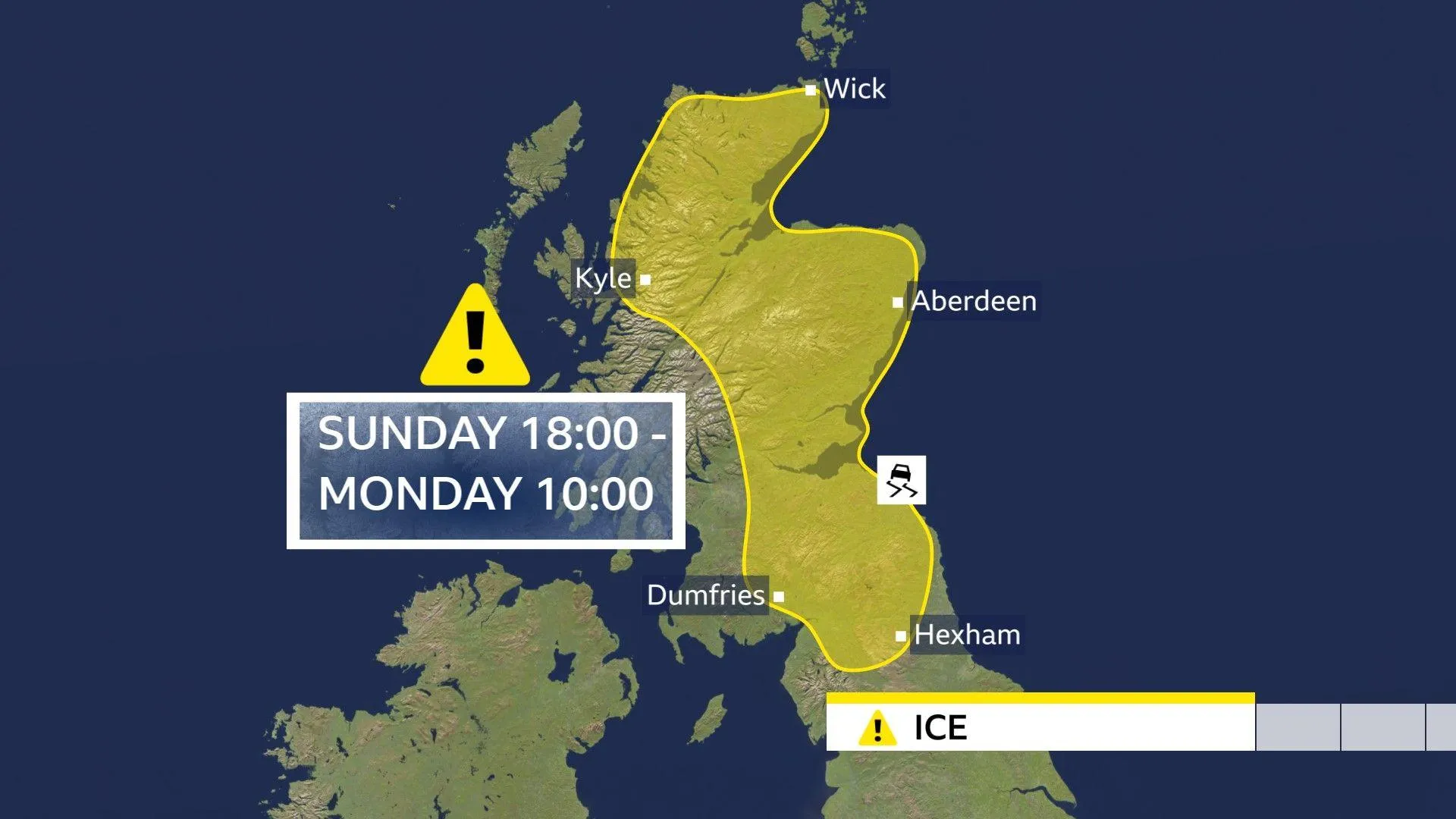
A spell of cold and wintry weather is anticipated to affect northern regions of the UK early this week, with warnings issued for ice and hill snow. A yellow weather warning for ice is in effect until 10:00 GMT on Monday, following a drop in temperatures due to Arctic air moving across the country on Sunday night. The UK Health Security Agency (UKHSA) has also issued cold health alerts for parts of northern England, which will remain in place until 21:00 GMT on Thursday.

Snow is forecasted over the hills and mountains in the north in the coming days, although the wintry chill is expected to be short-lived in the south. Temperatures in southern areas are likely to rise above average by midweek, providing some relief from the cold.

Injuries resulting from slips and falls on icy surfaces are a concern, and driving conditions may be hazardous on Monday morning. The coldest temperatures are expected in the northern half of the UK, while southern regions will generally experience milder conditions.

Weather Warnings and Health Alerts

The Met Office has issued a weather warning for ice until 10:00 GMT on Monday, specifically for northern and eastern Scotland, as well as parts of Cumbria, Northumberland, and Durham. In these areas, rain, sleet, or hill snow is likely to fall onto sub-zero surfaces, creating the risk of icy patches on untreated roads, pavements, and cycle paths.

Cold health alerts from the UKHSA are also active across north-west England, north-east England, Yorkshire, and the Humber until Thursday evening. These alerts are designed for health and social care professionals to prepare for the potential impacts of cold weather on vulnerable populations.

While Monday is expected to be dry and bright in many locations, wintry showers may affect some eastern parts of England and Scotland, particularly over higher ground where they may fall as sleet or snow. Afternoon temperatures are forecasted to range from 4 to 8 degrees Celsius, which is below the seasonal average.

Upcoming Weather Changes

As the day progresses, a new weather front will approach from the south-west, bringing milder air accompanied by heavy and persistent rain. This band of rain is expected to move northward overnight into Tuesday, potentially leading to further hill snow.

A yellow weather warning for snow will take effect on Tuesday from midnight until 12:00 GMT, covering the Midlands, north-east and north-west England, Yorkshire and the Humber, and parts of south-west Scotland. Accumulation of snow is likely, with depths ranging from 1 to 5 cm in most areas, while higher elevations above 300-400 metres could see between 5 to 15 cm.

Travel disruptions are anticipated, with some roads and railways likely to be affected, resulting in longer journey times for road, bus, and train services. Additionally, power cuts may occur in certain regions due to the adverse weather conditions.

In contrast, southern areas will experience a different weather pattern on Tuesday, characterised by blustery conditions and heavy showers. This clash of colder, drier weather in the north and milder, wetter conditions in the south is expected to persist into the middle of the week.

Long or Short, get news the way you like. No ads. No redirections. Download Newspin and Stay Alert, The CSR Journal Mobile app, for fast, crisp, clean updates!

App Store – https://apps.apple.com/in/app/newspin/id6746449540

Google Play Store – https://play.google.com/store/apps/details?id=com.inventifweb.newspin&pcampaignid=web_share

Latest News

Popular Videos
