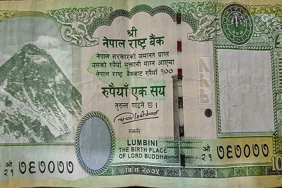
After Bangladesh and China, this time it is Nepal. The neighbouring country has created controversy by including disputed territory in its currency! Nepal has sparked a renewed border dispute with India by issuing new 100-rupee banknotes featuring a revised map that includes territories claimed by both nations.
The Nepal Rastra Bank (NRB) released the new notes on November 27, 2025, reviving a controversy that first emerged in 2020 when Nepal formally adopted the updated map. The controversial Kalapani, Lipulekh and Limpiyadhura regions have also been added to this map. India has protested against this.
Nepal’s new 100-rupee note has a picture of Mount Everest on the left. On the right is a watermark of Nepal’s national flower, Rhododendron. In the middle of the note, a map of Nepal is drawn in light green. The note also has a picture of Lumbini, the birthplace of Gautam Buddha, and an image of the Ashoka Pillar.
Nepal Rastra Bank (NRB) has launched notes of various denominations including 10 rupees, 50 rupees, 500 rupees and 1 thousand rupees notes. However, only the 100 rupee note has a map of Nepal. Regarding the controversy over the map, the bank spokesperson has clarified that the old 100 rupee note also has the same map image. He also said that this change in the map was made on the government’s instructions. The new note of Nepal Rastra Bank (NRB) has the signature of former Governor Mahaprasad Adhikari and the bank stated that the new note was approved in 2024.
Lipulekh, Kalapani, and Limpiyadhura dispute between India and Nepal
The controversy between India and Nepal over Lipulekh, Kalapani, and Limpiyadhura stems from differing interpretations of the 1816 Sugauli Treaty and historical maps, which define the Kali River as the border. Nepal claims the river’s source is at Limpiyadhura, placing these territories within its borders, while India contends the river originates further downstream near Kalapani, asserting these areas belong to the Indian state of Uttarakhand. The dispute intensified when India and China renewed border trade through the Lipulekh Pass, which Nepal considers its own territory.
The Nepal government led by former Prime Minister KP Sharma Oli had updated the map of the country. Kalapani, Lipulekh and Limpiyadhura regions were added to the map of Nepal with the approval of the Parliament in May 2020.
India has already protested against this change in Nepal’s map. Lipulekh, Kalapani and Limpiyadhura regions have been repeatedly claimed as part of India.
India reacted strongly to this incident in 2020. India called Nepal’s revised map a ‘unilateral act’. Kathmandu was warned against it. India claims that this incident is actually an attempt to forcibly change the country’s border. Nepal shares a 1,850-kilometer-long border with India. Nepal borders five Indian states, namely Sikkim, West Bengal, Bihar, Uttar Pradesh, and Uttarakhand.
Long or Short, get news the way you like. No ads. No redirections. Download Newspin and Stay Alert, The CSR Journal Mobile app, for fast, crisp, clean updates!
App Store – https://apps.apple.com/in/app/newspin/id6746449540
Google Play Store – https://play.google.com/store/apps/details?id=com.inventifweb.newspin&pcampaignid=web_share


