app-store-logo
play-store-logo
February 10, 2026

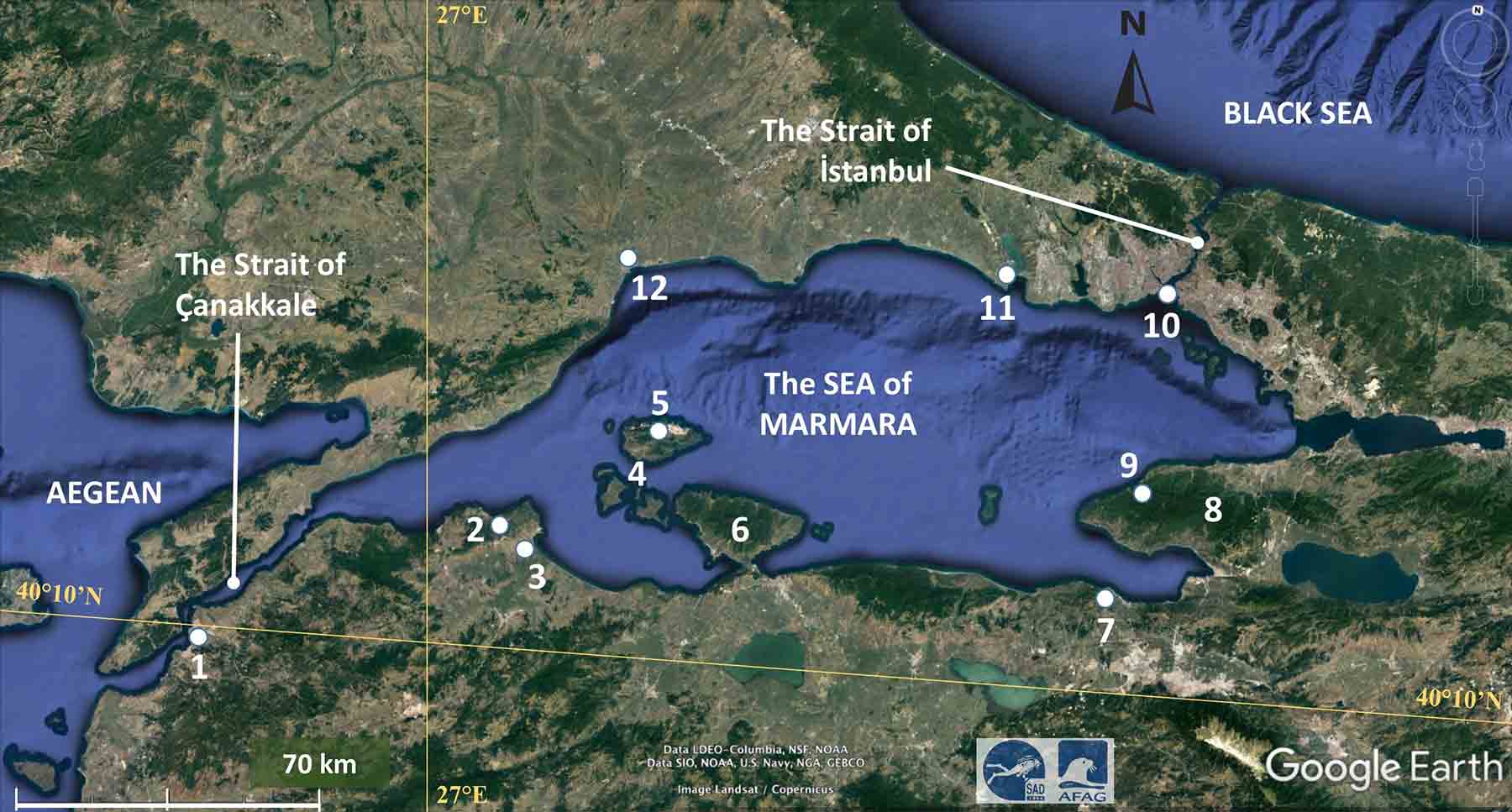
New Study Maps Hidden Fault Lines Beneath Marmara Sea, Raising Earthquake Risk Concerns

The CSR Journal Magazine

A new scientific study has provided the most detailed picture yet of the North Anatolian Fault system beneath the Marmara Sea, offering crucial insights into seismic risk in northwestern Turkey. The findings are particularly significant for densely populated regions such as Istanbul, which lies close to this major fault zone and has not experienced a large earthquake rupture in this segment for more than two centuries.

Understanding the North Anatolian Fault

The North Anatolian Fault is one of the world’s most active strike-slip fault systems, stretching roughly 1,500 kilometres across northern Turkey. It has been responsible for several devastating earthquakes, beginning with the 1939 Erzincan earthquake, after which ruptures progressively migrated westward. Scientists have long warned that the Marmara Sea segment could be a critical seismic gap where stress may be accumulating.

Breakthrough Using Advanced Imaging Techniques

To overcome long-standing challenges in studying offshore faults, researchers used magnetotelluric data, which measures natural variations in Earth’s electric and magnetic fields. Data from more than 20 land-based and seafloor stations around the Marmara Sea were combined to create the first three-dimensional electrical resistivity model of the fault zone beneath the sea.

This approach allowed scientists to peer tens of kilometres below the seabed, depths where earthquakes typically originate, offering insights not possible through conventional seismic imaging alone.

What the Subsurface Reveals

The study identified distinct underground zones with varying physical properties. Low-resistivity regions, which conduct electricity more easily, are thought to be fluid-rich and mechanically weaker, often associated with clusters of small earthquakes. In contrast, high-resistivity zones appear stronger and more rigid, suggesting fault sections that may remain locked for long periods, allowing stress to build up.

Researchers noted that the boundaries between weak and strong zones could play a crucial role in controlling where and how large earthquakes initiate.

Why Offshore Faults Are Hard to Study

Unlike faults on land, the Marmara Sea segment lacks dense monitoring infrastructure. Installing instruments underwater is expensive and technically complex, and seismic waves behave differently beneath the sea. As a result, scientists have historically had limited information about the deeper structure of this fault, making the new findings especially valuable.

Importantly, the researchers stress that the study does not predict when an earthquake will occur. Instead, it improves understanding of how rock strength, fluids, and fault geometry interact beneath the Marmara Sea. This knowledge can help refine future seismic hazard assessments, urban planning, and disaster preparedness strategies in Turkey.

A Step Forward, Not a Prediction

As Turkey remains one of the world’s most seismically active regions, the study represents a meaningful step toward better risk awareness. By revealing what lies beneath the Marmara Sea, scientists hope to support more informed decisions aimed at reducing the impact of future earthquakes rather than forecasting specific events.

Long or Short, get news the way you like. No ads. No redirections. Download Newspin and Stay Alert, The CSR Journal Mobile app, for fast, crisp, clean updates!

Latest News

Popular Videos