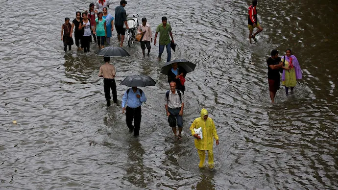
Intense Weather Patterns Expected Across India This Weekend

The CSR Journal Magazine

A significant shift in weather is anticipated across India, influenced by a strong western disturbance that previously caused flooding in the Middle East. The India Meteorological Department (IMD) and independent weather analysts project that the peak of this event will occur on March 29 and 30, delivering a combination of heavy rain, snow, and thunderstorms to various regions. Satellite imagery indicates robust moisture flow and cloud formations clustering over North and Central India, marking the onset of a widespread weather event.

Weather Predictions for March 29

Devendra Tripathi, founder of the weather platform Mausam Tak and a prominent weather vlogger, highlights that this atmospheric shift is a result of a unique convergence of moisture from the Arabian Sea, the Bay of Bengal, and the incoming western disturbance from the western Himalayan region. He elaborates that the moisture influx from these areas will significantly affect parts of the central peninsula and the northern regions of Madhya Pradesh, increasing atmospheric moisture levels over states such as Maharashtra, Gujarat, Chhattisgarh, Odisha, and Uttar Pradesh.

Warnings of Severe Weather Conditions

Weather expert Navdeep Dahiya has issued warnings regarding the impactful nature of this system, including potential adverse effects similar to those seen in Dubai. He notes that strong westerly jet streams are projected to affect North India starting March 29. Dahiya cautions that the trough associated with this disturbance could result in dust storms, moderate to heavy rainfall, and thunderstorms, raising alarms for upcoming severe weather events in the following week.

Regional Forecasts and Alerts

The IMD has issued a yellow alert for the northern mountainous regions, particularly Himachal Pradesh and Uttarakhand, which are predicted to experience light to moderate rainfall. Punjab is expected to face the most severe weather activity in the plains. Reports indicate that moderate to heavy thunderstorms and wind gusts reaching speeds of 50 to 60 km/h may begin tonight and last into tomorrow. Chandigarh is anticipated to have rainfall and thunderstorms between 9 AM and 1 PM IST on March 29.

Outlook for Other Regions

In contrast, Delhi and Haryana are likely to see minor impacts with isolated light rain anticipated from noon to evening on Sunday. However, the likelihood of thunderstorms and hail is expected to escalate across Rajasthan, Delhi, Gujarat, and Uttar Pradesh by March 30. Meanwhile, the IMD has issued a yellow alert for Hyderabad concerning thunderstorms associated with lightning and wind gusts reaching up to 50 km/h on Sunday.

Localized Weather Patterns Forecasted

Central India is also under scrutiny, with predictions for isolated hailstorms in Madhya Pradesh, Vidarbha, and Chhattisgarh. Tripathi notes that while rainfall is most likely in the northern regions, dense cloud cover is expected over areas like Amritsar and Jalandhar. In southern India, initial pre-monsoon activity might be observed in Telangana and Karnataka, although many areas could still experience dry and hot conditions. This evolving meteorological pattern, influenced by multiple cyclonic systems, signals a volatile phase in India’s weather transitions.

Long or Short, get news the way you like. No ads. No redirections. Download Newspin and Stay Alert, The CSR Journal Mobile app, for fast, crisp, clean updates!

App Store –  https://apps.apple.com/in/app/newspin/id6746449540 

Google Play Store – https://play.google.com/store/apps/details?id=com.inventifweb.newspin&pcampaignid=web_share

Latest News

Popular Videos